Mayors, take care of your wetlands!
-
Climate and disaster risks
-
Coastal resilience
-
Coastal wetland conservation
-
Community resilience
-
Rivers and lakes
Wetlands determine the sustainability, opportunities for growth and resilience of cities to a large extent. But their protective and provisioning services – often from far away in the surrounding landscape – are usually taken for granted, until we lose them. The urban summit Habitat-III in Quito is the time for mayors to stand up for wetlands and mobilise stakeholders to integrate these natural buffers into the new model for urban development.
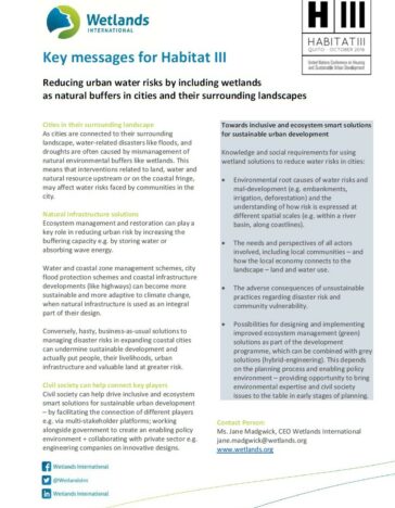
As cities are connected to their surrounding landscape, water-related disasters are often caused or exacerbated by mismanagement of natural environmental buffers like rivers or floodplains. Ecosystem management and restoration can play a key role in reducing risk and safeguarding sustainable development, are adaptive, often cost-effective and provide multiple benefits to society. They can be combined with grey solutions (hybrid-engineering) when environmental expertise and community perspectives are brought to the table in the early stages of planning.
Take the low-lying Juan Díaz sub-district of Panama City, which has become the most flood-prone area of the country. When heavy rains fall, run-off water cannot be absorbed by Juan Diaz floodplains, riverbeds and mangroves, as these have been used for landfills of up to 6 meters or have been disturbed by urban development. In September 2015 an exceptionally heavy rainstorm caused serious floods in areas that had never been flooded before. Residents organised and demand a halt to landfill.
How can resilience be built in this densely populated part of the city? Together with the vice-mayor of Panama and a Dutch DRR team, Wetlands International is bringing together all relevant stakeholders – communities, government, private sector – to exchange knowledge and assess scenarios including making room for the river and restoring wetlands and mangroves.
In a different part of the world, near the mouth of the Senegal river, Saint-Louis has become the city most threatened by floods in all of Africa. In 2003 intense rain overwhelmed dams upstream. Water had no space to outflow into surrounding wetlands and floodplains due to embankments, and caused a heavy flow downstream. To avoid catastrophic floods in the city, hastily a channel was excavated through the sand dunes, creating a short cut to the ocean.
But, exposed to the forces of nature from both sides, today the breach is 5.2 km wide and still growing. While the city of Saint-Louis is still threatened by rising waters, the thirsty lower Senegal river delta, which is home to outstanding national parks, is turning into desert land. The delta no longer benefits from an annual flood pulse due to upstream infrastructure. This also puts the food security of local farmers, fishers and pastoralists at risk.
Anticipating the floods and droughts to come, due to a changing climate, why not make more ‘room for the river’ within the floodplains by restoring the flood pulse to water-starved areas, instead of sending floodwaters straight out to sea? Findings of our study that mapped ecosystem services along the river basin advocate for an approach that combines wetlands restoration and infrastructure. This would restore the flood pulse and reduce flood and erosion risk, protecting Saint-Louis and the wider coastal region.
In conclusion, business-as-usual solutions for urban development and risk reduction that do not take into account adequate water management on a landscape scale, can undermine sustainable development and actually put cities at risk.
For mayors and urban planners it is important to recognise that development plans would benefit from an interdisciplinary and multi-stakeholder collaboration in which the development, humanitarian, and environment sectors are represented to develop a joint vision with regards to:
- The environmental root causes of risk
- An understanding of how risk is expressed at spatial scales (within a river basin or at a coastline)
- The needs and perspectives of all actors involved, including local communities
- The adverse consequences of unsustainable practices regarding community vulnerability
- Key role of wetlands to buffer extreme water related events in an urban context
- Possibilities for designing and implementing improved ecosystem management solutions as part of the development programme, which can be combined with grey solutions
Finally it is key to recognise and support the role of civil society to help drive inclusive and ecosystem smart solutions for sustainable urban development.
Step-by step guidance on the required capacities, partnerships, institutional set-up and planning needs when developing an ‘ecosystem-smart’ approach can be found in the document: Integrating ecosystems in resilience practice, by Wetlands International. It does not provide specific guidance on the technicalities behind interventions as these are typically highly site-specific.
Read our key messages for Habitat III: