Extreme flooding predicted in Mali’s Inner Niger Delta
-
Climate and disaster risks
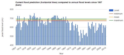
Bamako, Mali – The latest OPIDIN flood forecasting bulletin released by Direction Nationale de l’Hydraulique and Wetlands International predicts extremely high floods in the Inner Niger Delta, Mali. New figures indicate that the coming annual Niger River flood is likely to become the highest such event in the last 50 years, putting lives, property and infrastructure at risk.
The water levels measured on 6 September were the highest since 1964 in the Inner Niger Delta. In that year, the inundated area covered 22,000 km2, while last year the inundation was only 14,000 km2. Flooding this year will reach its peak in November and December. Wetlands International asks humanitarian organisations and the government in Mali to cooperate to take appropriate measures for managing the risks.
“The people in Mali’s Inner Niger Delta are dependent on the annual flood to support their livelihoods of farming, fishing and pastoralism. This year’s flood will be the largest in 50 years. While the Niger River is a lifeline in this dry region, the people here are currently not adapted to such a large flood. Unless we prepare now, lives, property and infrastructure may be lost due to this extreme event,” said Karounga Keïta, coordinator of Wetlands International in Mali.
The Inner Niger Delta is the second largest floodplain wetland in Africa. The extent of flooding depends on the amount of rainfall in the highlands of Guinea, hundreds of kilometres upstream, and varies from year to year. Flooding was robust in the 1950s and 1960s, but in the 1970s and 1980s it was characterised by very low flood levels, corresponding with drought and famine in the region. The flood is strong this year due to high rainfall in the early rainy season in Guinea and Mali combined with a high groundwater table.
Flood forecasting tool
OPIDIN (Outil de Prédiction des Inondations dans la Delta Intérieur du Niger) is an online flood forecasting tool. Based on daily water level measurements and satellite-derived daily rainfall estimates for the Upper Niger, it predicts the level and timing of the flood peak as well as the maximal flood extent in the Inner Niger Delta. Since the launch of the tool in 2013, predictions have been accurate and have been made available via a website and radio broadcasts to people in Mali.
The impact of climate change and infrastructure on the Upper Niger Basin
The size of the flooding is influenced by a range of factors including climate change and infrastructure.
“Climate researchers predict greater variability in water supply, with more rainfall in the Upper Niger Basin,” states Jane Madgwick, CEO of Wetlands International. “Rain is expected to fall with greater intensity in shorter periods of time, making the basin more drought and flood prone.” This year, the area being maximally inundated is expected to be 2.5 times larger than in dry years.
New infrastructure such as dams and irrigation will increase the variability in the Niger River flow. This will specifically have an impact in low rainfall years. The expectation is that the construction of the Fomi dam in Guinea and expansion of the irrigated area in Office du Niger will increase the likelihood of an disaster year due to low flood levels in the Inner Niger Delta by a factor 8.
More information: www.opidin.org
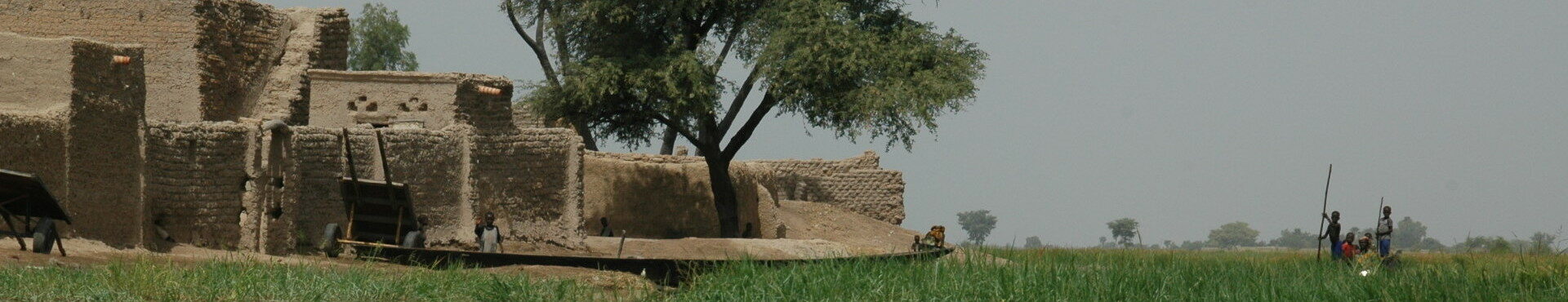
Header image © Leo Zwarts