
From alerts to action: protecting the mangroves of the Casamance through remote sensing data
-
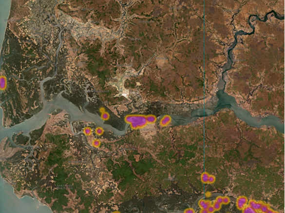
Global Mangrove Watch
In the village of Séleki, deep in Senegal’s Casamance region, mangroves were quietly disappearing — not from logging, but from a less visible threat. Through the alert functionality of Global Mangrove Watch, our local team — Boubacar Sagna and Khadim Diop — were notified of the loss – an area of 2 hectares. Together with Marine Protected Area officer Capitaine Agustin Sadio, they travelled to the site and uncovered the source of the degradation: dikes.
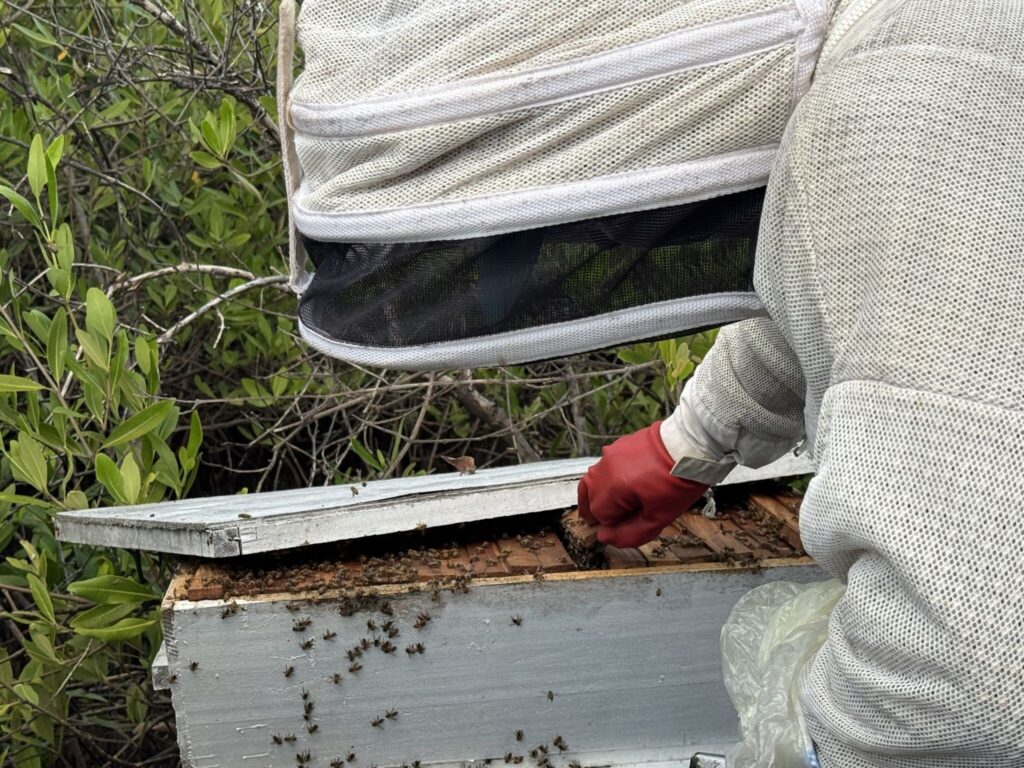
The mangroves of the Casamance are more than just trees. They are a vital buffer against floods and sea level rise. They provide valuable products that form the livelihoods of many such as fish, oysters, and honey.
Unfortunately, these ecosystems are under constant pressure from both human activity and natural shifts. The good news is that solutions to restore mangroves exist. But to implement them, we need to know exactly where degradation has happened. The Marine Protected Areas of this region are vast, and it is impossible for a small group of rangers to patrol the entire area.
What if satellites out in space could monitor mangroves? What if there were a way for us to know, almost in real time, where we should direct our limited time and resources to conserve this ecosystem?
This is exactly what Global Mangrove Watch does. It is an online platform that provides remote sensing data and tools for monitoring mangroves. With hi-res information on mangrove loss, Global Mangrove Watch gives Marine Protected Area managers, conservationists, policymakers and practitioners the evidence needed to respond to illegal logging, pinpoint the causes of local mangrove loss and track restoration progress.
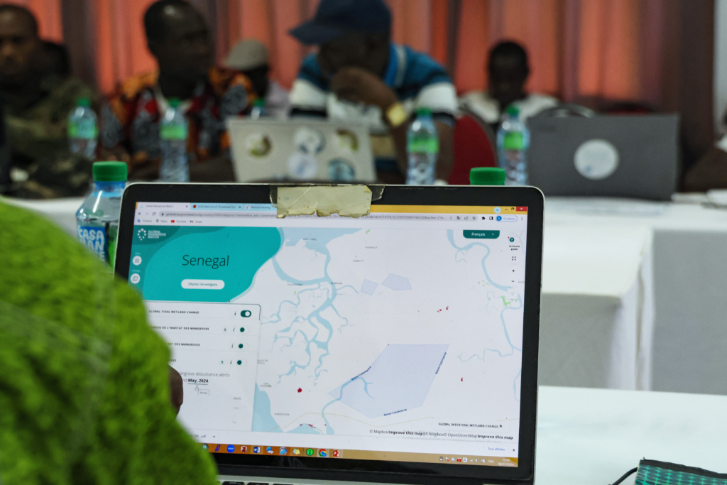
Under Wetlands International’s Rooted Resilience project, supported by The Swedish Postcode Lottery Foundation, we trained various stakeholders including local authorities and students to use Global Mangrove Watch in the Casamance. Rangers can now monitor their whole area, allowing them to dedicate their limited time to work with communities to conserve mangroves.
The Story of Séleki: from aquaculture ponds to mangrove-based sustainable livelihoods
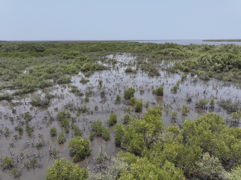
In Séleki, located within the UKB Marine Protected Area (Ufoyaal Kassa-Bandial), we found that the dikes were built to create ponds for aquaculture. But these dikes blocked the natural flow of the brackish water, and over time, deprived of the tidal rhythm they needed to survive, the mangroves began to wither.
Conservation is not just about the environment; it’s about people. Wetlands International Afrique are currently facilitating the exchange between the Séleki community, the National Aquaculture Agency, and the owner of the dike to develop alternative sustainable livelihoods. By finding new ways to support food security that don’t require blocking the tides, we can reopen the dikes and allow the ecosystem to heal. Our focus is on Community-Based Ecological Mangrove Restoration, a method that aims to jointly with communities to restore the conditions for mangroves to regrow naturally.
Kalone-Bliss Kassa
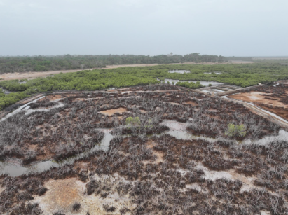
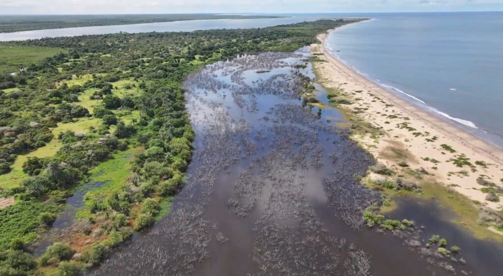
Not all degradation is caused by humans. In the KBK Marine Protected Area (Kalone-Bliss Kassa), GMW detected a different kind of mangrove loss. Roughly 16 hectares of mangroves are currently dying off due to a natural phenomenon: the shifting of a large sand dune.
This dune has acted as a natural plug, cutting off the vital water inflow that the forest depends on. This case serves as a stark reminder that even in protected areas, mangroves are vulnerable to the physical changes of a shifting coastline.
This site is very important for several species of birds such as cormorants and egrets. An impact study is currently needed to assess outcomes of potential interventions.
Niamone-Kalounayes
A third alert was noted in the MPA Niamone-Kalounayes. It is clear that mangroves have been cut here, but the reason for cutting is not completely known (therefore we don’t know the legality of these actions). We assume this could be done for fencing vegetable gardens in the region or to use the wood for product transformation. Because of the alerts by Global Mangrove Watch, the MPA is patrolling the area regularly to make sure there isn’t further degradation.
By combining satellite technology with deep community engagement and government partnerships, we are ensuring that the mangroves of the Casamance region continue to protect the coast for generations to come. The journey from a digital alert to a restored mangrove forest is long, but in places like Séleki, the first steps toward recovery have already begun, bringing hope to the communities that depend on mangrove ecosystems.