
Global Mangrove Watch spots massive mangrove loss in Mozambique
In recent years Mozambique has faced a number of threats to its mangrove forests, including exploitation of resources (such as wood for firewood), destruction due to aquaculture and saltpan development, logging, urban encroachment, destruction due to port development and extreme weather events such as flooding and cyclones.
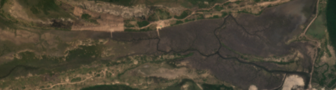
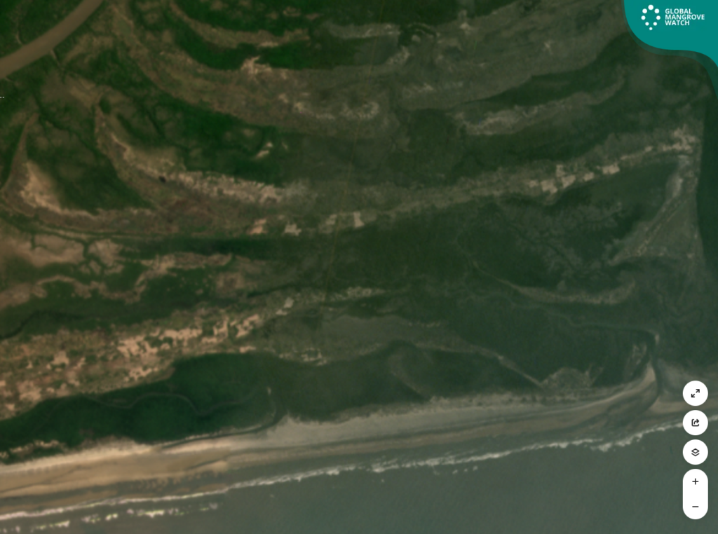
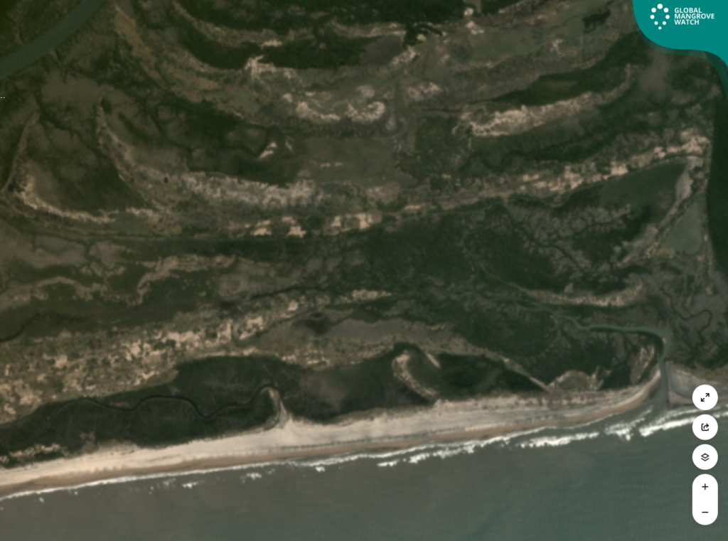
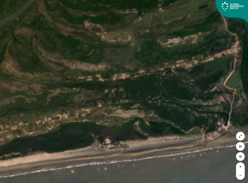
Recent satellite analysis using Global Mangrove Watch alerts has revealed a significant and concerning loss of mangrove habitat in the Zambezi Delta, Mozambique — one of the most ecologically important and expansive mangrove systems in Africa. Because of its immense value, the Zambezi Delta was listed as a Wetland of International Importance by the Convention on Wetlands in 2004. There are over 2500 such Ramsar Sites across the world but only two in Mozambique.
The full story has been published on Mongabay which reveals the cause to be heavy sand mining.
Screenshots from GMW documenting mangrove degradation
A slideshow with 6 images
The slider is set to loop infinitely.
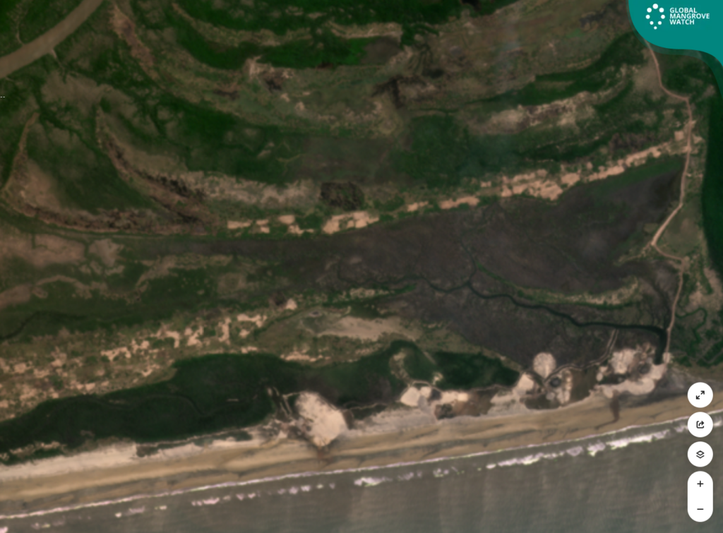
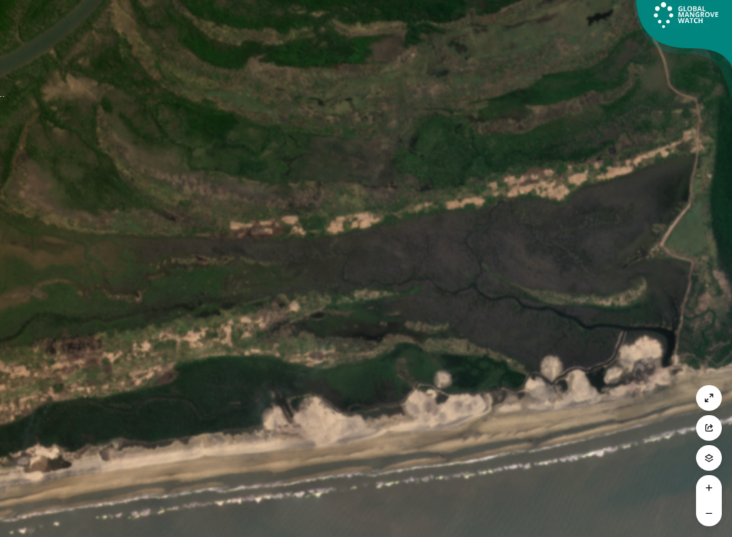
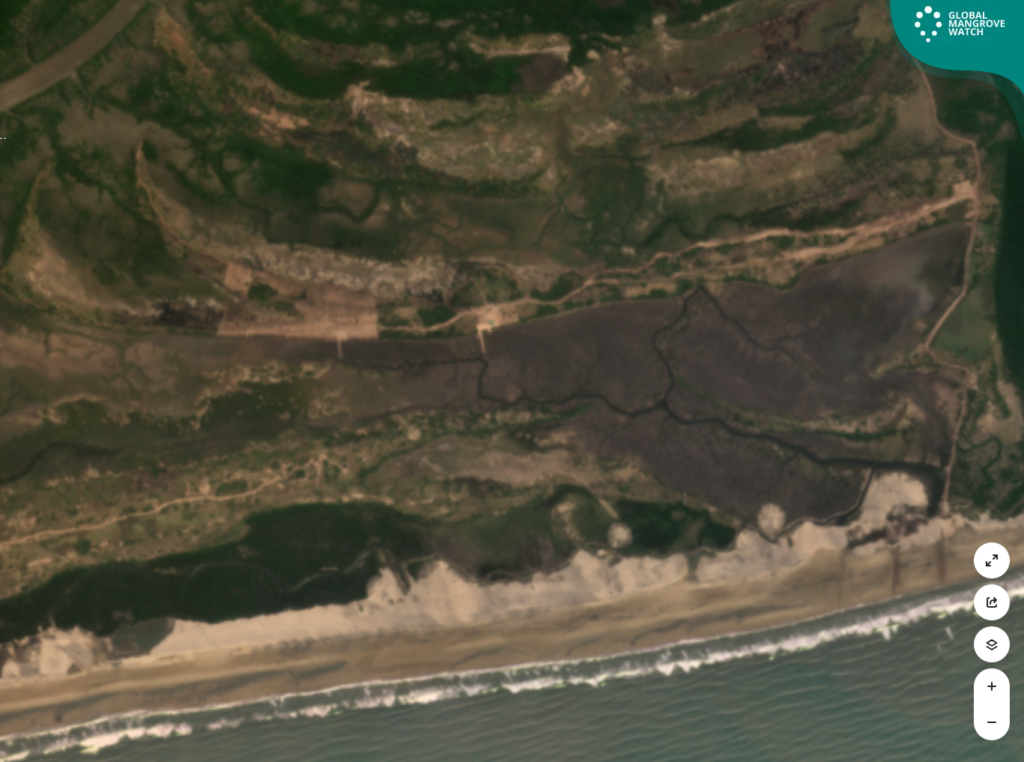
Sand is the second-most exploited natural resource in the world after water. Marine sand is a staple in construction, but the world’s reserves are being depleted at rates never seen before. And unfortunately, there is no global standard for the extraction of sand.
Mining of this kind is harmful for both people and nature. These are irreplaceable ecosystems whose value to people and planet far outweighs the short-term profit extracted from their destruction. Disturbing these ecosystems not only threatens biodiversity but also undermines community resilience and national commitments to climate adaptation and mitigation. Mangroves are not expendable. They are essential. Their protection must be a national and global priority. Therefore, when sand mining is unavoidable, Wetlands International recommends that companies consult with local environmental experts on the least invasive ways to do so. In this case, for example, unblocking the channel or creating alternative canals to restore the flow of water might be sufficient to revive the degraded mangroves.
Why does the Zambezi Delta matter?
The Zambezi Delta in Mozambique, is one of the most diverse and productive river delta systems in the world and is home to some of the most extensive coastal communities on the East African coast. Mozambique harbours the largest extent of mangroves in the Western Indian Ocean region. Its coastline boasts around 10% of Africa’s mangroves. 16% of Mozambique’s mangroves are in the Zambezi Delta, which is the country’s largest continuous mangrove area.
Mangroves are powerful carbon sinks and Mozambique’s mangroves sequester well over one third (39%) of the country’s annual fossil fuel emissions. The Zambezi Delta is a blue carbon hotspot, harbouring high amounts of above- and below-ground mangrove biomass and sediment carbon. This coastal wetland provides protection against sea level rise and storm surges, a service that will only become more vital as climate change intensifies.
Mangroves also play a critical role in supporting the livelihoods of people living in coastal areas in Mozambique, including the 400,000 people who directly depend on mangrove-associated fisheries. Mozambique’s mangroves have been estimated to provide US$ 7 billion in annual net benefits to the national economy.
The Delta supports a significant population of large mammals including the African buffalo, elephant, hippopotamus, lion and leopard, and a large concentration of waterbird species including white-backed and pink-backed pelicans, herons, flamingos, and endangered grey crowned cranes. Bottlenose and humpback dolphins and a variety of marine and freshwater fish and shellfish species have also been recorded in the area.
About the Global Mangrove Watch
Global Mangrove Watch (GMW) is an online platform that provides the remote sensing data and tools for monitoring mangroves necessary for this. It gives universal access to near real-time information on changes to mangrove habitats across the world. With hi-res information on topography, soil conditions and hydrology, GMW gives coastal and park managers, conservationists, policymakers and practitioners the evidence needed to respond to mangrove loss, pinpoint potential causes of loss and track restoration progress. It is a tool that can help mangroves be central to climate mitigation, adaptation and sustainable development plans and policies.